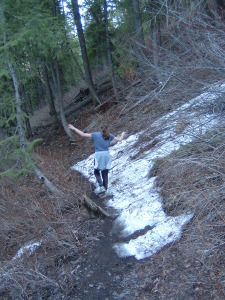
Before I jump into a description of what’s been opened recently, a couple words of caution. Some of the trails that are now open contain short sections of ice and snow. Some are very slippery and tilted. Trekking poles and footwear traction-devices can be helpful aids for staying upright on these icy spots. Look ahead and turn back if you come across an area that appears to be too slick for your safe passage. Also, keep an eye on the weather and give the trails enough time to dry out following rain and snow events. A little patience can go a long way toward keeping the trails in good shape.
Here is a breakdown of the roads and trails that have been opened most recently on the Ketchum Ranger District:
- The Fox Creek Trail #149 is partially open from the Fox Creek Trailhead side. From the trailhead, you can follow the Fox Creek Trail for about 1.5 miles to the summit of the climb.
- Other out-and-back opportunities off of the lower reaches of the Fox Creek Trail have been opened. Traveling west from the trailhead, you’ll come across the North Fork Trail #303 on the right after about a quarter-mile. The North Fork Trail is only open for about one-half mile. At the top of the climb the trail enters the woods and becomes more north facing. Here, you will find wet conditions. There is no closed sign indicating where you should turn around on this trail. Use good judgment and turn back where conditions get icy, snowy, wet, or muddy. Please do not try to push over to the Chocolate Gulch Trail, as the section you would be heading toward is also closed due to wet conditions.
- The southwest end of the Chocolate Gulch Trail #312 can be accessed for an out-and-back trip from the Fox Creek Trail. This intersection of the Fox Creek Trail and the Chocolate Gulch Trail is approximately one mile west of the Fox Creek Trailhead. The Chocolate Gulch Trail can be followed for about 1.2 miles up to the top of the outcropping and onto the hilltop meadow. There is a closed sign on the trail near the far end of the meadow, closing the trail where it bends around to the north to become tree covered and wet.
- You can check out the east side of the Oregon-Fox Connector Trail #311. At this time, it can only be accessed off of the open portion of the Chocolate Gulch Trail. These trails intersect near the bottom of the Chocolate Gulch Trail. The OR-Fox Connector Trail #311 heads west here, and is dry for a fair way. There is no closed sign out on the trail indicating where people should turn back. Please turn around where you hit icy, snowy, wet, or muddy conditions.
- In the vicinity of Adams Gulch, the Adams-Lake Creek Connector Trail #321, Harper’s Trail #323, and the “Pork Chop” section of the Adams Rib Trail #142 are open. You can use these trails to help form a loop from the Adams Gulch Trailhead.
- On Baldy the River Run Trail #330 is open for short out-and-back trips. The Bald Mountain Trail #201 is open for a couple of miles for out-and-back hikes. There are no closed sign out on these trails indicating where people should turn back. Please turn around where you hit icy, snowy, wet, or muddy conditions.
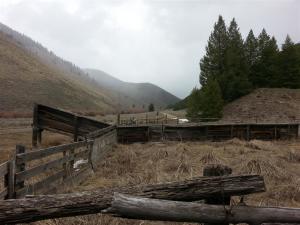
- East of Sun Valley the Corral Creek Road is open, and the Corral Creek Trail #325 is partially open. The only section of the Corral Creek Trail that remains closed is the highest section that travels between the short spur camping road and the corrals in Uncle John’s Gulch. Using the Corral Creek Road, one can access the Pioneer Cabin Trailhead and short out-and-back trips on the lower reaches of the Long Gulch Trail # 123 and the Pioneer Cabin Trail #122. There are no closed sign out on these trails indicating where people should turn back. Please turn around where you hit icy, snowy, wet, or muddy conditions.
- Some additional trails have opened in the Greenhorn drainage. The Greenhorn Trail #156 is now partially open for out-and-back trips and as portions of a couple of low loop opportunities. The Greenhorn trail is open from the trailhead for about 2.5 miles; to a point where the trail is signed as closed at wet conditions. The Mahoney Ridge/Cow Creek Connector Trail #153 is open. This allows for a connection to the Lodgepole Trail #310. Above this intersection the Lodgepole Trail is closed due to wet conditions. A loop can be formed by using the Mahoney Ridge/Cow Creek Connector Trail, the lowest portion of the Lodgepole Trail, the Mahoney Trail #821, and the lowest portion of the Greenhorn Trail. Imperial Trail #315 is partially open for out-and-back trips for approximately 2 miles.
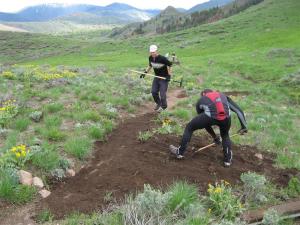
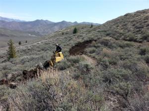
- The BLM and BCRD teamed up last week to reconstruct the turns in the southwest portion of the Hidden Valley Trail. The rebuilding is complete and the trail is open and available for rides, walks and runs.
Here is a link to the Ketchum Ranger District’s most recent trail and road report: April 22, 2015 Ketchum Ranger District Trail Report
Have a great day out on your trails!

3 comments for “Slippin’ Into The Season”