Baldy trails
Sun Valley Resort recently announced the opening of the Bald Mountain Trail up to the Lilly Marlane cat-track. However, please note that the trail is accessible for out-and-back hikes only, and there is a firm closure beyond the cat-track. This closure is necessary to ensure the safety of both the recreating public and the crew members involved in resort construction and mountain forest health projects.
Upcoming vol efforts
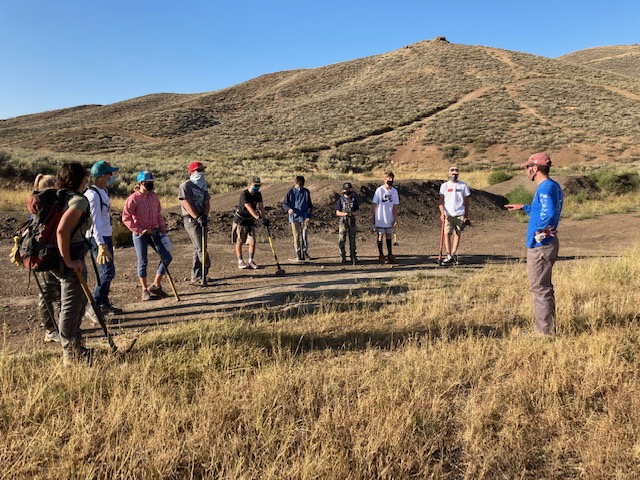
The next volunteer trail work event is tomorrow, Saturday, June 3 at the BLM Croy TH. The event is hosted by the Wood River Trails Coalition, Pulaski Users Group, and Blaine County Recreation District. For info visit the WRTC events calendar page at: https://woodrivertrailscoalition.org/calendar
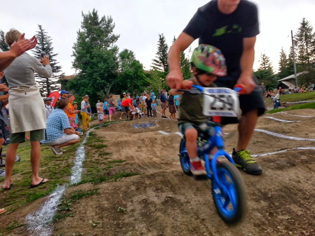
Volunteers are working to rebuild the Ketchum Bike Park, a place that is very popular with valley youth. A film screening of “8,600 Feet” is serving as a fund raiser for the work on June 6. For info check out this recent article by reporter Raiza Giorgi of the Idaho Mountain Express: https://www.mtexpress.com/arts_and_events/arts/get-pumped-for-riding-with-8600ft-screening-june-6/article_7c54f0ae-fc0d-11ed-9c24-cfdf97e71a3b.html
KRD Trail Crew
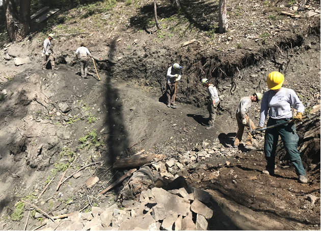
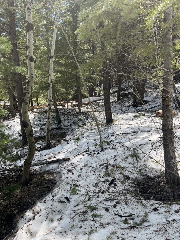
So far this week, the Ketchum Ranger District Trail Crew performed maintenance on Chocolate Gulch, North Fork (trail that makes a connection between Fox Creek and Chocolate Gulch trails), Fox Creek (thank you volunteer John Straka for cutting-out the trees that were down along the trail), Taylor Canyon, and Saddle trails (Saddle makes a connection from the Oregon Gulch TH to the Chocolate Gulch Trail). They are cut-out and open. The KRD crew also worked in Greenhorn, on the Imperial Trail. The crew reports that Imperial was still too muddy on Thursday, so please stay off until it has dried further.
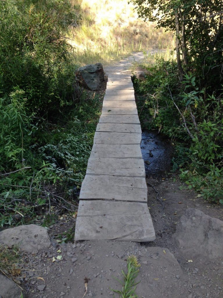
The Fox Creek Trail is open, but the trail crosses over footbridges, which are partially submerged in Fox Creek. This means that individuals who don’t mind getting their feet wet can still enjoy the trail as a loop. Others have the option to use it for out-and-back trips. Access to the trail is restricted due to flooding at the BLM Lake Creek and FS Fox Creek trailheads. However, an alternative route in is available by parking at the Wood River Trail Trailhead. It is found at Highway 75 and the entrance road into the Hulen Meadows subdivision. From there, you can walk, run, or ride a bicycle to reach the trail. It’s important to note that there is no public parking available in the more interior areas of the subdivision.
Access to the Fox Creek Trail, and other open or partially-open trails, can also be gained from more distant access points and trailheads. As an example, from the Oregon Gulch Trailhead, Saddle Trail (cut-out and open) can be taken to Chocolate Gulch Trail (cut-out and open), which can be used as a connection to the Fox Creek Trail.
Adams Gulch Trailhead work
Next week, from Monday to Wednesday, there will be a temporary closure of one-half of the Adams Gulch TH parking lot. This closure is necessary for the replacement of the trailhead toilet. During this time, please make use of the available parking space while being mindful of the restricted area.
The footbridges found along the Old Adams Gulch Road Trail are in the process of being upgraded. New bridges have been installed, but work is ongoing on the ramps that lead up to them. Be cautious as you approach any bridges. Stay well back from any active work as the crew or equipment operators may not be immediately aware of your approach. If you wish to pass by a bridge work area, signal to the crew members present to help make them aware of your presence. Wait until they have provided instructions to you before proceeding toward the area they are working in.
SNRA trail report
Here is a link to the latest Sawtooth National Recreation Area trail report:
May 31, 2023 SNRA Trail Report
additional TH and road info
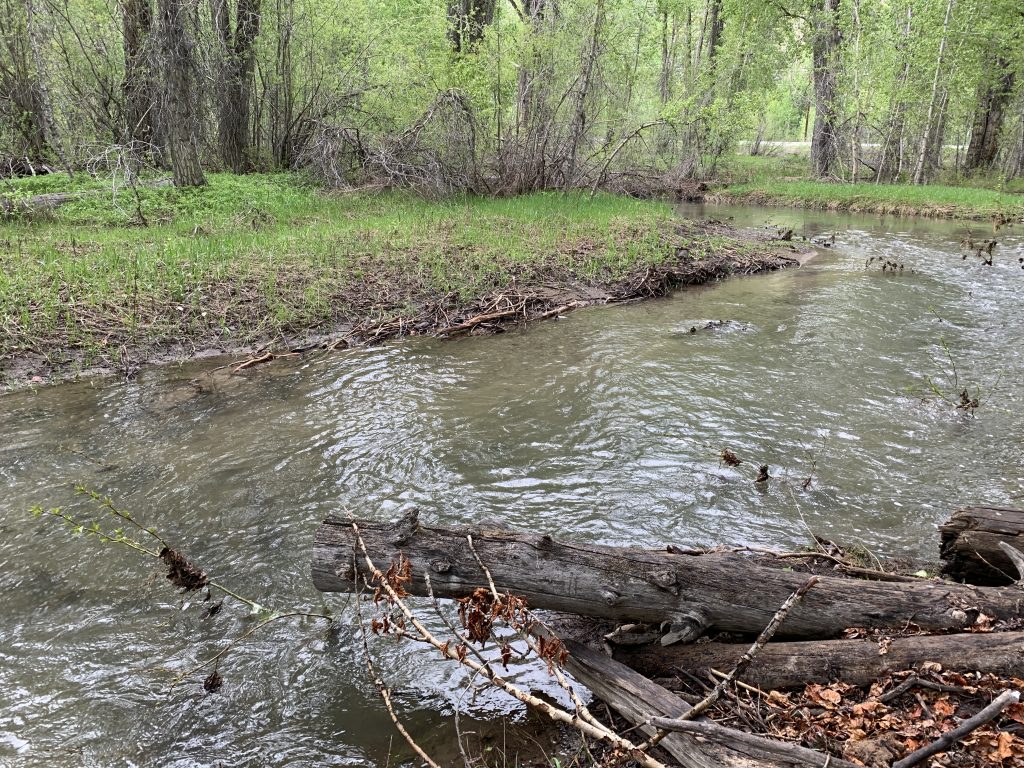
At the BLM Lake Creek TH, the Big Wood River has dropped significantly, but the trail on the opposite side of the large metal footbridge is still underwater. Besides getting wet feet, your knees, and maybe your thighs, will get wet too, if you try to cross the more interior “creek” that is flowing across the land on the far side of the footbridge. Please give this access a bit more time before using it to gain the Fox Creek Trail or Harper’s Trail (Harper’s is partially-open).
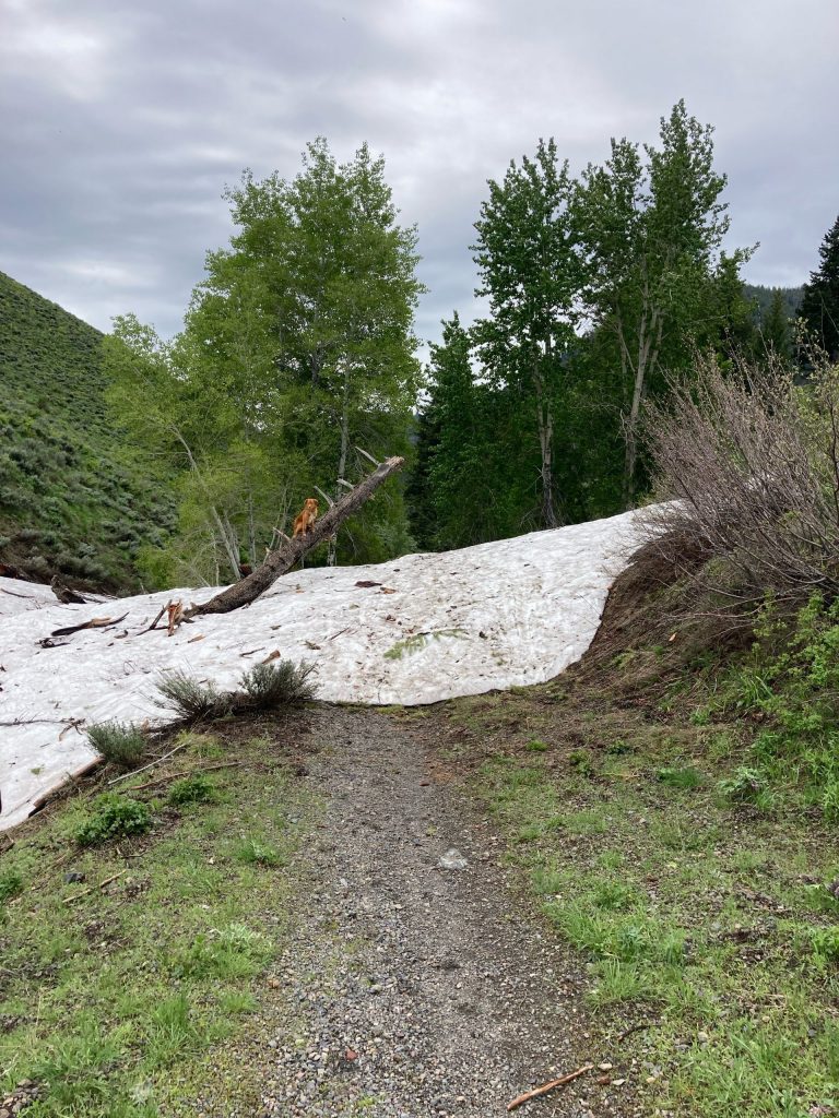
Baker Creek Road is open to Brodie Gulch, with standing snow beyond. You can get to Norton Creek Road, which is open to the Norton/Miner TH. The trails emanating from the TH are partially-open for short out-and-backs to snow holding on the Norton-Miner Canyon Trail, and avalanche debris up the Norton Creek/Prairie Creek Trail.
Warm Springs Road is open to Rooks Creek (partially-open – expect trees down, snow, avi debris)
Sheep
A band of sheep is in Timber Gulch. On 6/12 they will enter the Limekiln area.
Bands of sheep are accompanied by herders and sheep guard dogs, which protect the sheep from predators. Some sheep guard dogs may act antagonistically toward people and their pets. Keep pets leashed. The Trail Alerts section of the BCRD Summer TraiLink site includes a variety resources about recommended best practices for interacting with bands of sheep. Here is a link: BCRD Summer TraiLink Trail Alerts.
Greenhorn update
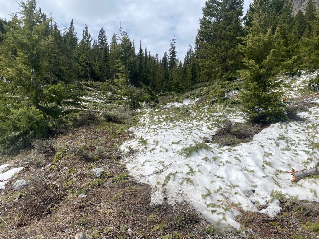
In Greenhorn Gulch, things have not changed a lot, but there are certainly opportunities for rides, runs, and hikes. As I mentioned last week, the large footbridge near the trailhead is compromised, so fording the creek may be a safer way across Greenhorn Creek. As for the Greenhorn Trail, it is partially-open. You can use the lower section of the trail for out-and-backs, which will lead you to a sizable avalanche debris pile. Another option is to incorporate the Greenhorn Trail into a loop by combining it with the Cowhorn and Cow Creek Connector trails.
The Mahoney Trail #821 is currently partially-open, due to an extended stretch of water flowing on the trail. Additionally, there is a fallen tree on the Mahoney Trail, making it nearly impossible to pass through.
Also in Greenhorn, the Cow Creek Trail #180 (partially-open), Cow Creek Short Cut Trail #930 (open), and the Cow Creek Connector Trail #153 (open) can be used to form a loop. The higher reaches of the east-side of the Cow Creek Trail #180 were running water a week ago. It has rained a lot over the course of the last week, so it may still be rather wet and muddy if you were to try and get across the top.
Lodgepole is partially-open to downed trees, snow, avalanche debris. Thanks John Reagle for the work on Lodgepole filling in a large area of failed trail and for cutting out a bunch of trees from the open and partially-open trails in Greenhorn.
Deer Creek
Roads are open in Deer Creek, except for Wolftone Road, which is partially-open due to avalanche debris. Deer Creek Trail is closed due to avalanche debris and flooding. North Fork Deer Creek Trail is partially-open with reports of avalanche debris.
Hyndman area trails
Parker and Bear are partially-open and can be used for out-and-backs. Johnstone Creek Trail is partially-open and can be used for out-and-backs. The trails at the end of Hyndman Creek Road and departing the Hyndman Creek TH are partially-open. These include North Fork Hyndman Creek and Hyndman Creek trails. Expect snow, trees down, and avalanche debris.
Corral Creek Road is open to the Pioneer Cabin TH. Long Gulch Trail is partially-open for out-and-backs. The Pioneer Cabin Trail is closed due to snow and downed trees.