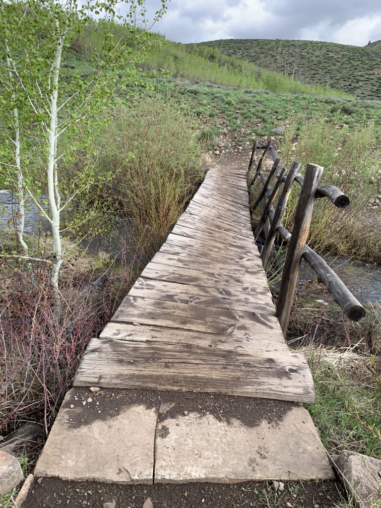
Greenhorn Road is open to the TH. The large footbridge near the TH, which crosses Greenhorn Creek, is damaged and tilted. It may be possible to cross it on foot, but the nearby creek ford may be a safer way to cross the creek.
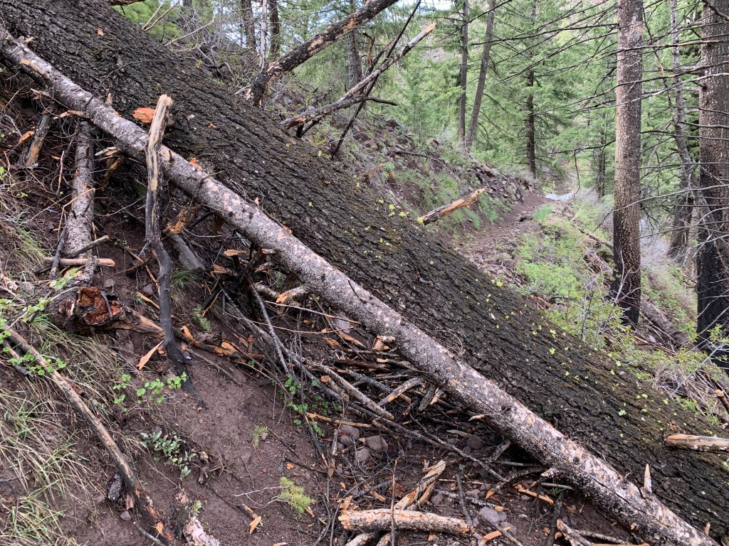
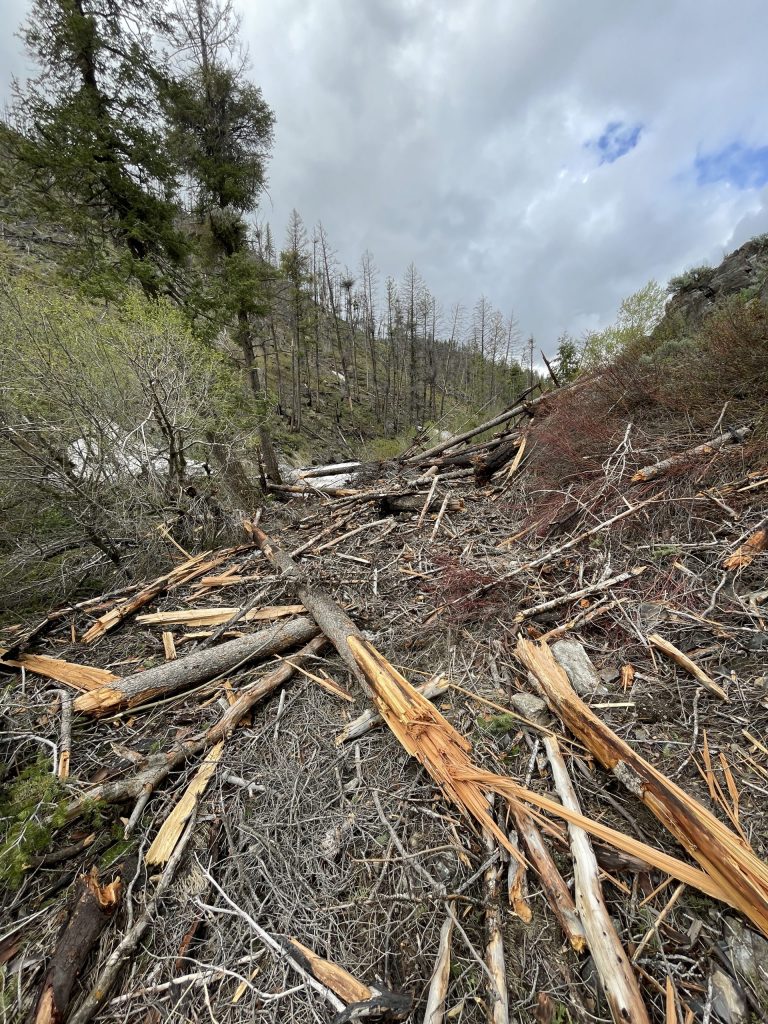
The Greenhorn Trail is partially-open. It can be utilized on its low end for out-and-backs or as part of a loop utilizing Cowhorn Trail and the Cow Creek Connector Trail. The Mahoney Trail #821 is closed due to water running on the trail for a great length. Additionally, there is a nearly impassable downed-tree up the Mahoney Trail.
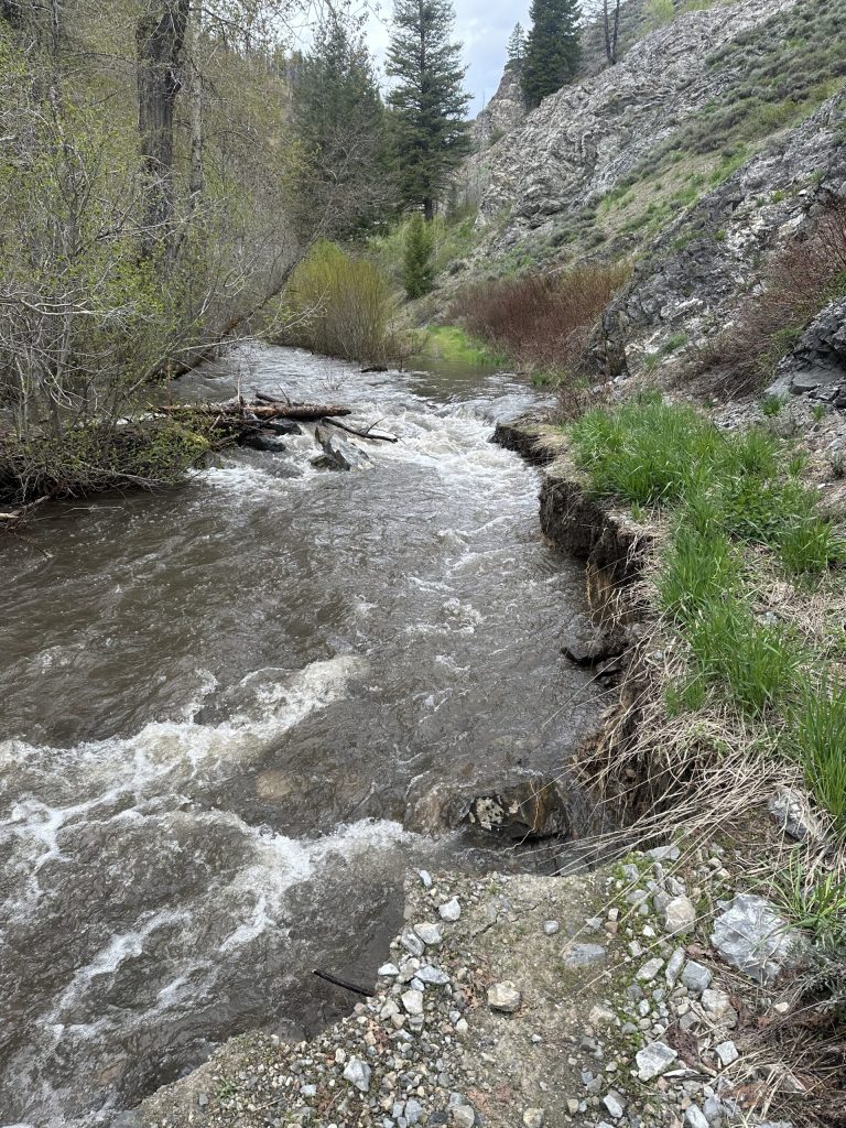
Also in Greenhorn, the Cow Creek Trail #180, Cow Creek Short Cut Trail #930, and the Cow Creek Connector Trail #153 can be used to form a loop. The higher reaches of the Cow Creek Trail #180 are running water for a long stretch, so it is recommended for out-and-back use above its intersection with the Cow Creek Short Cut Trail.
Also in Greenhorn, Imperial Gulch Trail was still too muddy for use on Friday. The bottom 1/8 mile was dry, but at a very muddy turn, water was leaking out of the trail and things were messy.
In the Deer Creek drainage, Deer Creek Road is open to campsite #18, which is between Wolftone Road and North Fork Deer Creek Road. Avalanche debris is blocking Deer Creek Road at that point. The Deer Creek and North Fork Deer Creek trailheads are accessible by foot or bike, but Deer Creek Trail is closed due to avalanche debris and flood damage. At the North Fork Deer Creek TH, areas of avalanche debris start about 1/4 mile up the North Fork Deer Creek Trail. Wolftone Road is blocked down low by avi debris.
In Adams Gulch, Sunnyside – Lane’s Trail, and Citizens Trail, are open for out-and-backs. The Old Adams Gulch Road Trail is partially-open. At last check there was still quite a lot of snow holding on the higher and shadier sections of the Old Adams Gulch Road Trail. The Adams – Lake Creek Connector Trail can be used for an out-and-back from the Adams Gulch TH.
No trail access is available at the BLM Lake Creek or the FS Fox Creek trailheads. At last check, the Big Wood River was over the trails on the far sides of the trailhead footbridges. The bench-land trails north of Hulen Meadows subdivision, and above the Lake Creek Trailhead (these are some of the more southern portions of Fox Creek Trail), can be used for out-and-backs – access them by walking or bicycling in from the parking area near the Hwy (at the entrance to the Hulen Meadows subdivision). No public parking is available at the more interior areas of the subdivision.
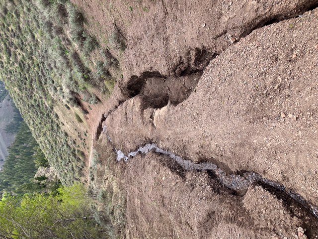
The Oregon Gulch Trail can be used for out-and-backs.
Lake Creek Road is open to the pond. The Taylor Canyon Trail is partially-open for out-and-backs.
The Sun Valley Resort’s White Cloud Trails are open.
Corral Creek Road is open to the Pioneer Cabin TH, but the Pioneer Cabin Trail remains closed due to snow and muddy conditions. Long Gulch Trail is partially-open for out-and-backs. Corral Creek Trail is open. The Ketchum Ranger District Trail Crew cut-out most all of the Corral Creek Trail on Thursday. One large, difficult to pass avalanche debris pile remains on the Corral Creek Trail. The Corral Creek Trail is recommended for use as an out-and-back at this time. Aspen Loop Trail is cut-out and open. Proctor is cut-out and open with two small avalanche debris piles remaining along the trail.
East Fork Road is open about a mile past Federal Gulch Campground, where the road is blocked by avalanche debris. Both Sawmill and Federal Gulch campgrounds are open. Federal Gulch Trail is very wet and not ready for traffic.
Hyndman Creek Road is open to the TH at its end. The trails departing the road, and from the trailhead, are partially-open for out-and-backs, but expect snow, trees down, and areas of avalanche debris.
West of Hailey, all of the BLM Croy Trail network is open. Thank you Wood River Trails Coalition volunteers and staff for the maintenance work you performed on the Hidden Valley Trail last Tuesday night. The group’s next volunteer trail maintenance event brings together a number of organizations who work to bring volunteer muscle to our regional trails. The WRTC, PUG and the BCRD are teaming up to lead the day’s volunteer trail work. The work event is on Saturday, June 3, from 9 to noon at the Croy Creek TH, with food to follow at Hop Porter Park. Visit the WRTC volunteer info page for more details.
Democrat Road was graded recently by Blaine Co. Road and Bridge. The gate at the bottom of the road is open.
On the east side of Hailey, most of the trails at the BCRD Quigley Trails Park are open. Quigley Canyon Road is partially-open with much rutting and other roadway damage up high.
Cove Creek Road is partially-open with areas of avalanche debris across sections of the roadway.
Baker Creek Road is closed 4.3 miles up the road, at avalanche debris. East Fork Baker Creek Road is closed 0.9 miles up, at deep snow.