The Ketchum Ranger District has closed the West Fork of Warm Springs Road today due to unstable roadway conditions. Efforts are being made to fix the issue, but currently, there is no trail or road connection between Warm Springs Road and Eve Gulch/Adams Gulch.
A band of sheep is in the vicinity of Panther Gulch in the Deer Creek drainage. Another band is in the vicinity of Limekiln Gulch in Greenhorn. Bands of sheep are accompanied by herders and sheep guard dogs, which protect the sheep from predators. Some sheep guard dogs may act antagonistically toward people and their pets. Keep pets leashed. For more information on how to interact with sheep guard dogs visit to the Trail Alerts section of the BCRD Summer TraiLink site. Here is a link: https://summertrailink.bcrd.org/trail-alerts.php
Many creeks and rivers are still raging. Exercise caution and plan ahead. Avoid assuming the possibility of crossing creeks and rivers that may be encountered along your route. If you encounter deep or fast-flowing water, turn back and retrace your steps. Stay out and stay alive.
Not all water-crossings are dangerous. Some are down and are generally safe to cross. Examples include places like the BLM Lake Creek and FS Fox Creek trailheads, which are still seeing high water, but are now approachable for access to many popular routes.
This week, Kent May, Trails Supervisor for the Ketchum Ranger District made the following report:
Welcome to the second day with no rain! Word on the street is that it rained 44 days in a row, I think the KRD Trail Crew can attest….This week the crew worked on:
Pioneer Cabin Trail (the trail is cut-out and open)
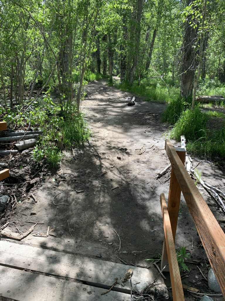
Eves Gulch (clear up to Serpent Trail)
Forbidden Fruit (all clear)
Federal Gulch (clear to the saddle and its high intersection with Timber Draw Trail)
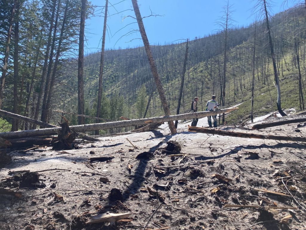
Timber Draw (large snowslide one mile up the trail from its low intersection with Federal Gulch Trail)
Next week:
I hope everyone has an awesome weekend.
Cheers,
Kent
The lower portion of the Oregon Gulch Trail was cut-out about a week ago by the Ketchum Ranger District Trail Crew. We have a report that the upper three miles of the Oregon Gulch Trail (known locally as “Edge of the World”) was recently cut-out by an e-biking volunteer. Additionally, the report indicated that the volunteer also cut-out the majority of the trees that were down across the East Fork Baker Creek Road. There may be some remaining downed-trees and snow holding on the roadway.
The lower section of the River Run Trail is open on Bald Mountain. The Pale Rider Trail (bicycle use only) is also open. The Bald Mountain Trail is open for out-and-back hikes to the Lily Marlane cat-road.
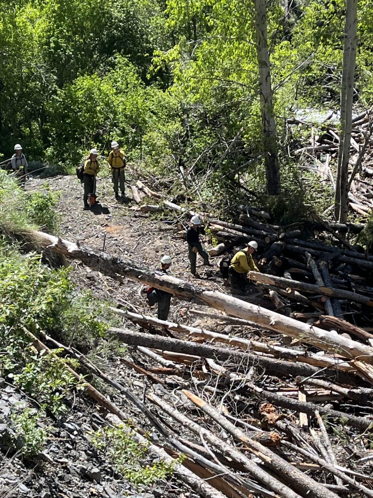
So far this season, motorcyclist volunteers from the Wood River Trails Coalition have cleared more than 200 trees from local trails, with their current focus on the Red Warrior and Warfield areas. Progress on connecting several trails in the Warm Springs, Greenhorn, and Deer Creek regions is hindered primarily by impassable creeks and rivers, lingering deep snow, and extensive avalanche debris piles.
Galena Lodge is open for the summer season. Most trails are available for use, but some are closed until June 26 to protect wildlife. Check the BCRD Summer TraiLink site maps for which trails are closed for wildlife, indicated in red. (Tip: To zoom-in to see the trails at Galena Lodge on the BCRD Summer TraiLink site, look above and to the right side of the main-page map for the “Galena” tab. Click the tab to zoom-in on the Galena Lodge trails.) All trails on the east side of the highway (lodge side of highway), are cleared and open. However, the trails on the west side may still have snow and downed-trees across them, as they have not seen maintenance and are only partially open, except for the North Wood Loop Trail, which is closed for wildlife.
The Sawtooth National Recreation Area issued an updated trail report with information that the wildflowers are in bloom at lower elevations with snow elevations at approximately 8,000 to 8,500 feet with creeks running very high and fast. Crews and partners are starting to perform trail maintenance and to clear trails of downed wood. If anyone has recently traveled on a trail and would like to share their findings, the SNRA information staff would love to hear from you. Contact the SNRA by calling or visiting any SNRA ranger station, visitors center or headquarters, or email SNRA Information Specialist Hannah Fake at: Hannah.fake@usda.gov
Here is a link to the latest Sawtooth National Recreation Area Trail Report: June 15, 2023 SNRA Trail Report